
New EUDR Regulation
Even though most deforestation occurs beyond the EU's borders, the EU market is directly responsible for deforestation on the demand side. New EU Deforestation Regulation (EUDR) seeks to reduce the EU's role in deforestation and forest degradation. It focuses on seven commodities – cattle, timber, palm oil, soy, cocoa, coffee, and rubber – as well as some derived products including leather, chocolate, and furniture, constituting a paradigm shift toward tackling agricultural-driven deforestation.
One of the new EUDR legislature requirements is the obligatory provision of geolocation coordinates of harvested trees. The geolocation coordinates need to be provided in the due diligence statements that operators are required to submit to the Information System ahead of the placing on the Union market or the export of the products. It is therefore a core part of the Regulation, which prohibits the placing on the market, or the export, of any product covered by the Regulation scope whose geolocation coordinates have not been collected and submitted as part of a due diligence statement.
-
How does EUDR describe the obligation of provision of geolocation information?
Article 9 (Information requirements) states that the operators shall collect various information including:
"the geolocation of all plots of land where the relevant commodities that the relevant product contains, or has been made using, were produced, as well as the date or time range of production; where a relevant product contains or has been made with relevant commodities produced on different plots of land, the geolocation of all different plots of land shall be included; any deforestation or forest degradation on the given plots of land shall automatically disqualify all relevant commodities and relevant products from those plots of land from being placed or made available on the market or exported (...)"
-
What does the geolocation requirement (within the EUDR) look like from a practical point of view?
Article 2 defines geolocation as:
‘Geolocation’ means the geographical location of a plot of land described by means of latitude and longitude coordinates corresponding to at least one latitude and one longitude point and using at least six decimal digits; for plots of land of more than four hectares used for the production of the relevant commodities other than cattle, this shall be provided using polygons with sufficient latitude and longitude points to describe the perimeter of each plot of land.
Beyond EUDR requirements
Furthermore, the benefits of geolocation go beyond deforestation prevention. Harvesting trees is a crucial aspect of forestry management and the wood industry, and as the demand for wood products continues to grow, it becomes increasingly important to implement efficient and sustainable harvesting practices. Geolocation technology has emerged as a powerful tool in this endeavour, offering a range of benefits that streamline the tree harvesting process while minimising its environmental impact.
-
Enabling precision and efficiency
Geolocation allows forestry professionals to precisely locate individual trees and entire stands. This accuracy plays a pivotal role in optimising tree harvesting operations. By knowing the exact locations of trees, forestry workers can plan and execute their operations more efficiently, reducing time and labour costs.
It aids in creating effective routes for logging equipment, minimising unnecessary travel and disturbance to the surrounding ecosystem.
-
Supporting selective harvesting
It supports selective harvesting. Selective harvesting involves strategically choosing which trees to remove while leaving others to continue growing. Geolocation data enables forestry managers to identify mature trees that are ready for harvest, ensuring that younger, smaller trees remain untouched. This practice promotes sustainable forestry by allowing the forest to regenerate naturally and maintain its ecological balance over time.
-
Improving decision-making
Incorporating geolocation data into tree harvesting operations provides valuable insights for decision-making. Forestry managers can analyse geospatial information to optimise the allocation of resources, plan transportation routes, and allocate equipment effectively. By leveraging this data, they can make informed choices that lead to better productivity, reduced waste, and increased profitability.
How does geolocation application look like on the ground?
This July, we have visited a public FSC certified forest near the city of Gradiška in the Republic of Srpska, Bosnia and Herzegovina, under the management of the public company "Šume Republike Srpske". Local foresters took us to the harvesting site, where the pilot program of geolocation of trees marked for harvest was readily demonstrated to us. Have a look at the at the impressive geolocation application in this public forest management company!
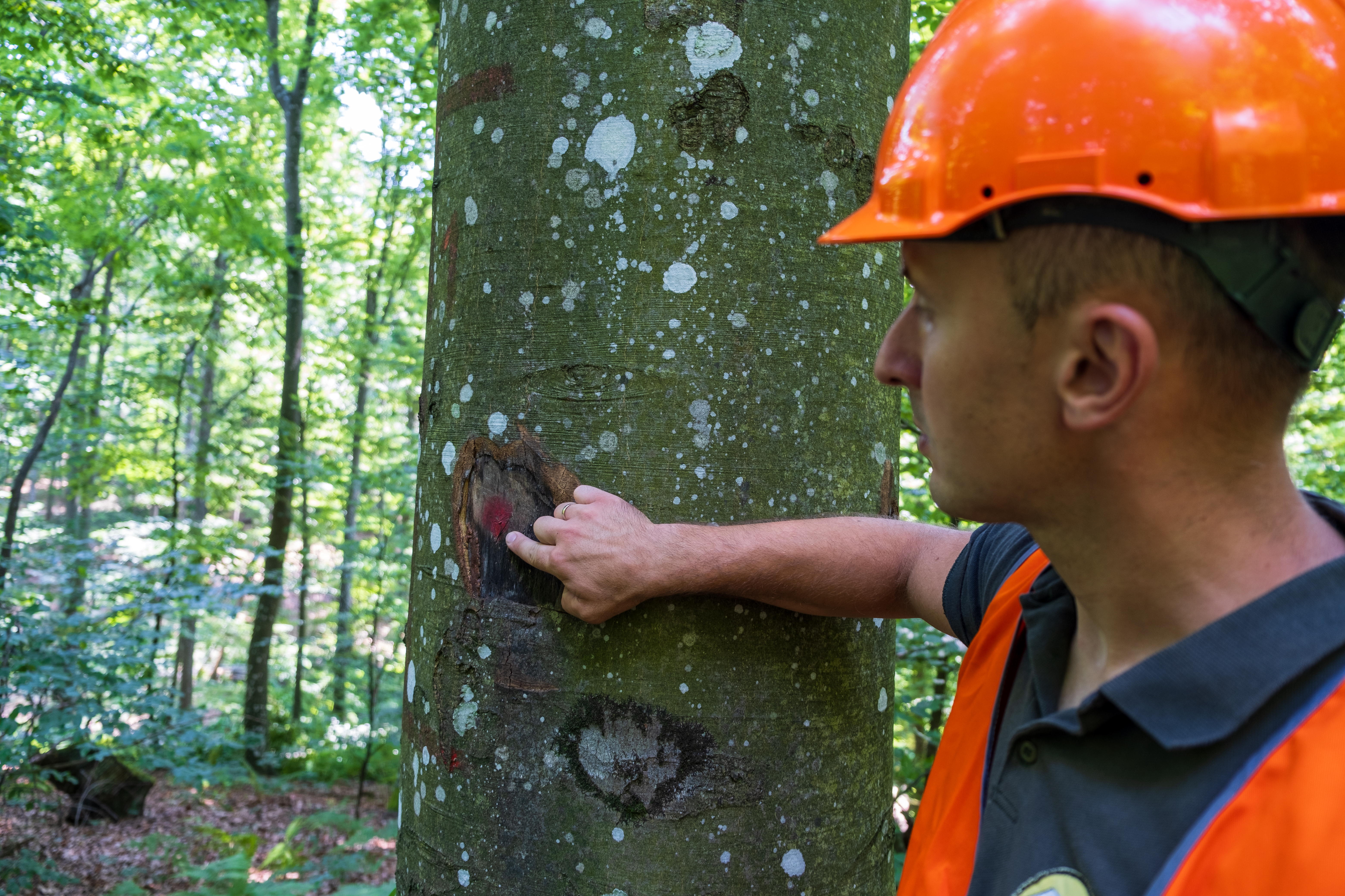
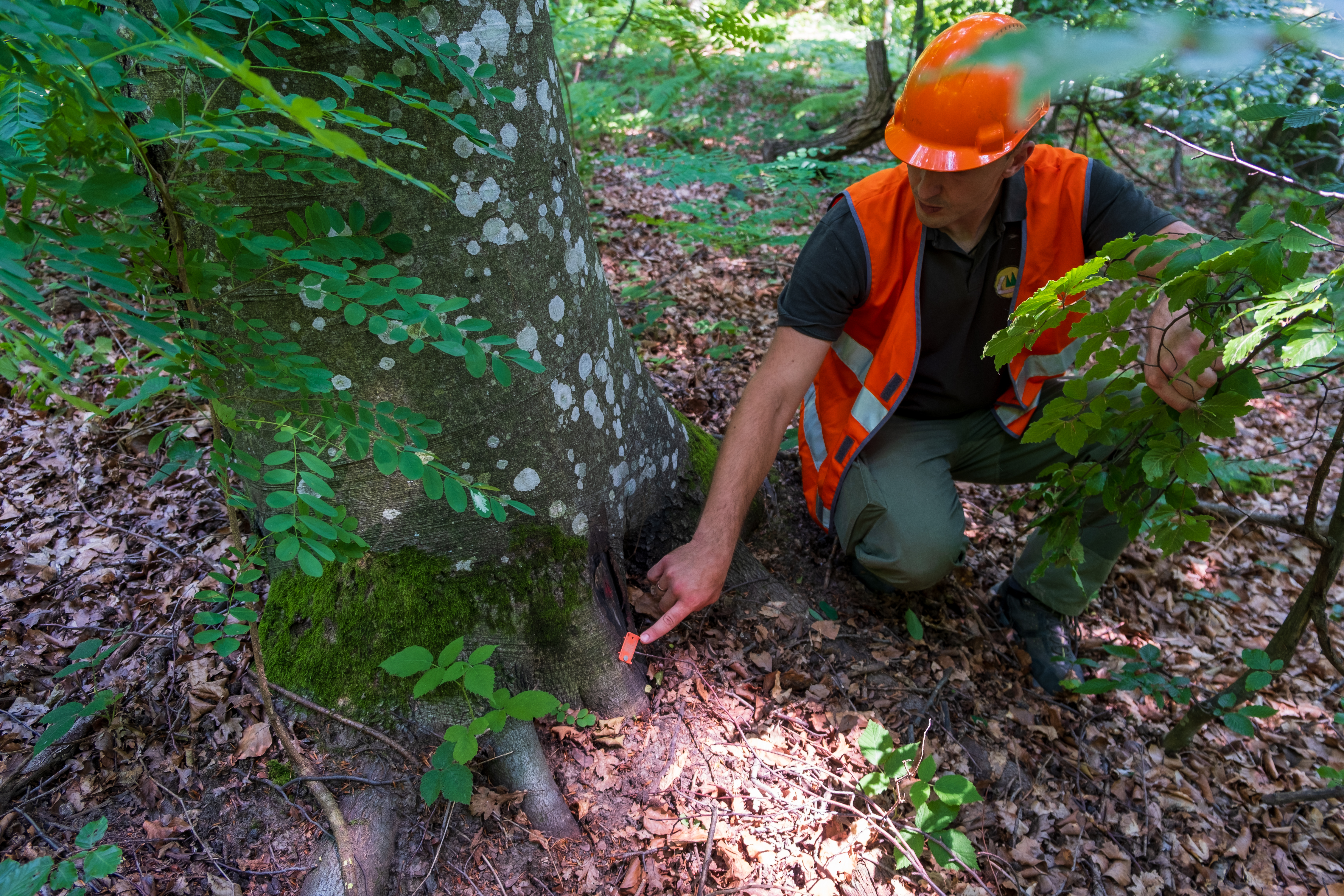
Selecting the trees for harvest
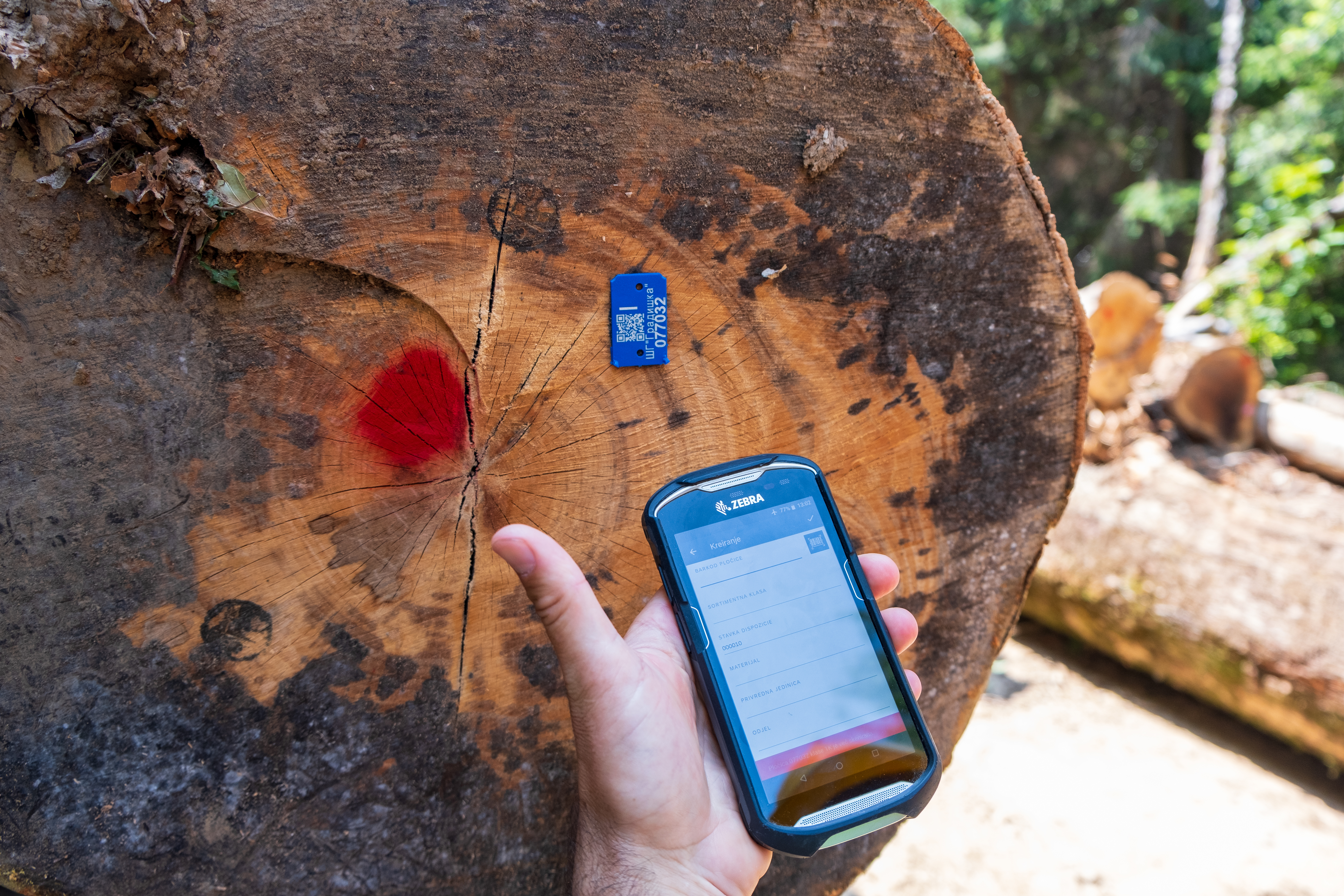
Following the selective silviculture method appropriate for the hilly terrain of north Bosnia and Herzegovina, mature trees are identified and selected for the upcoming harvest by experienced forest engineers. Each tree planned for the harvest is marked at breast height with an identifier dot and a stamp, which are easily identifiable by forest workers in charge for the felling. Using the GPS locating device, each tree marked for felling is also geolocated at this point with precise GPS coordinates, which are paired with a unique QR tag that is placed at the bottom of the tree trunk - a future stump.
Harvesting
When the seasons comes, and the conditions are appropriate for harvest, forest workers enter the forest plot looking for marked trees. They carefully fell the marked trees, leaving them on the forest ground. This method of selective harvesting leaves more space for the younger trees to prosper.
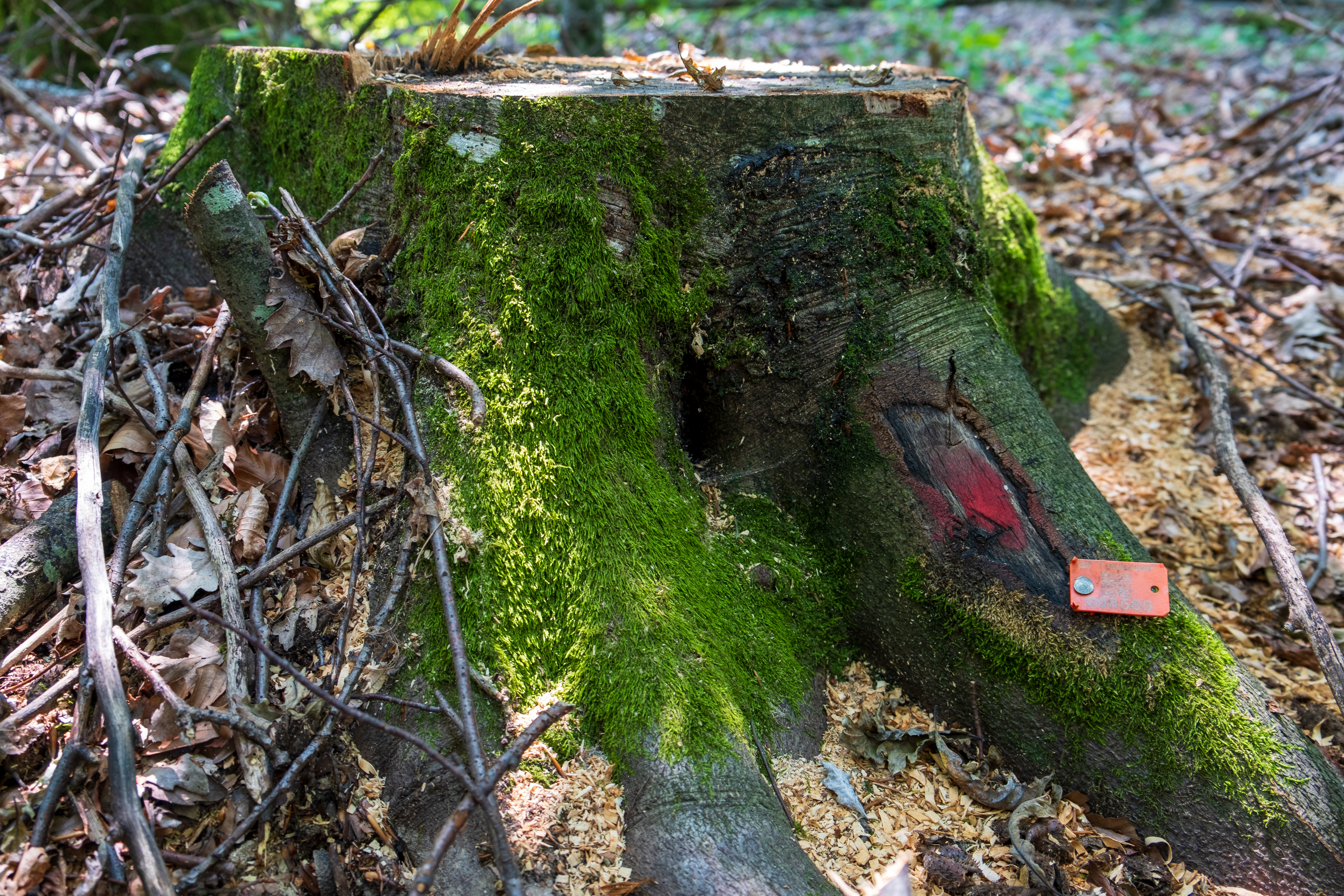
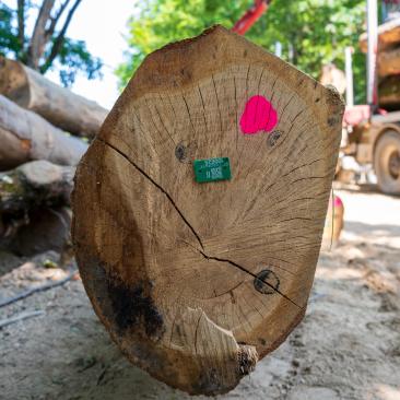
Geolocation of the harvested wood assortments
Following the felling and prior to the collection of felled material, forest engineers enter the plot to categorize felled timer into different wood categories and to pair each part of the felled tree with its corresponding GPS coordinates. This is done using the tags of various colors. Each tag color represents a specific wood category, while the unique QR code located on the same tag gets paired with the original QR code of the felled tree, located in the bottom of the stump, thus ensuring the information about the GPS coordinates remains with the felled timber.
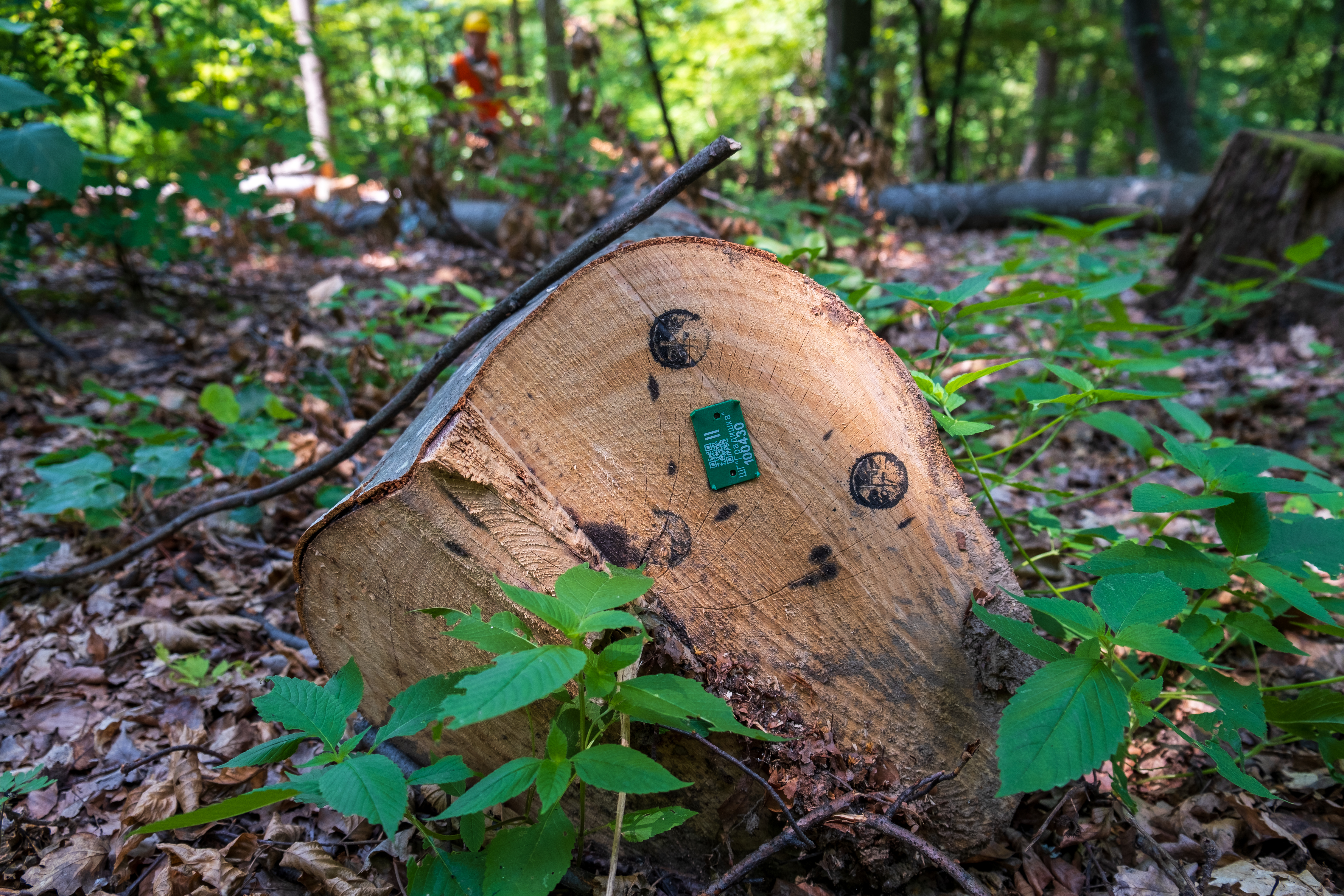
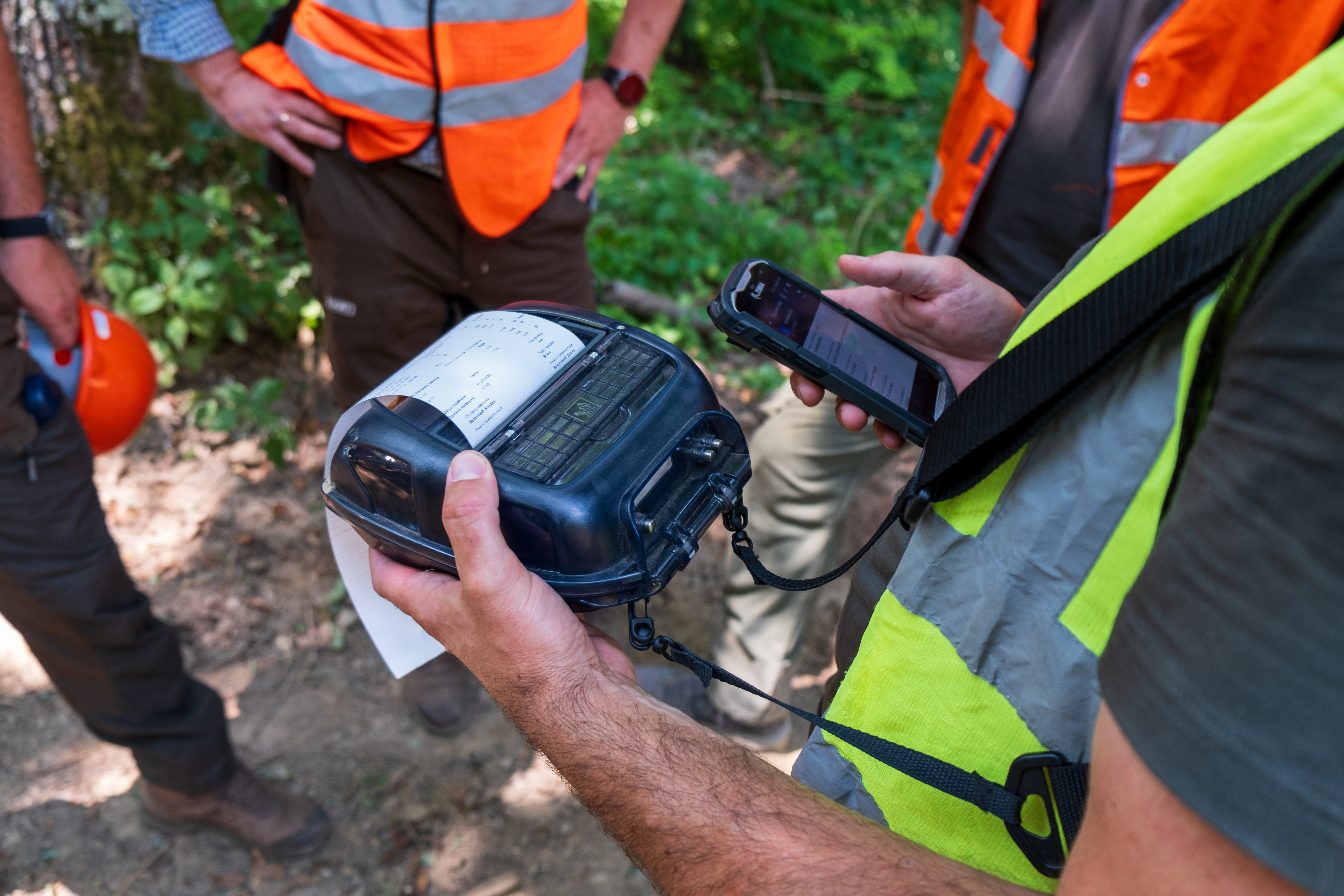
Final control
After the collection of felled, categorized, and geolocated timber from the forest and onto the side of the road, but prior to loading onto a wood transport truck, a forest engineer in charge on site has to double check each piece of timber, by scanning the QR codes on the associated tags with a special handy device, and confirming once more that every piece of wood is accompanied by the appropriate information about the GPS coordinates of its origin. Once the wood is controlled, it is marked with a special dot, thus signaling the final control was completed, and this wood is ready to be loaded onto truck for further processing elsewhere.
Geolocated future
With geolocation application, precise GPS coordinates can follow each wood assortment along the chain of custody, enabling the most accurate insight into the origin of the material for future buyers and sellers, as well as the much-needed core information, in case a wood assortment is being placed on the EU market. As the industry advances, continued investment in geolocation technology promises to lead to more sustainable, efficient and environmentally conscious logging practices, as well as an accurate insight into the origin of wood products in order to aid prevention of further deforestation. Demonstrated pilot project of geolocation in the public forest management company "Šume Republike Srpske" is an excellent example of a forward-thinking initiative that will enable this public company to remain competitive and serve its clients with sufficient geolocation data, required by the new EUDR Regulation in case the final product, such as the famous Bosnian furniture, ends up on the territory of the European Union - a likely scenario!